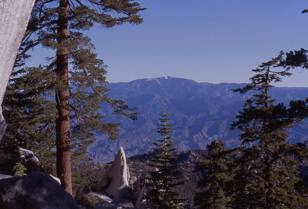
A view north of Mt. San Gorgonio
from Fuller Ridge.
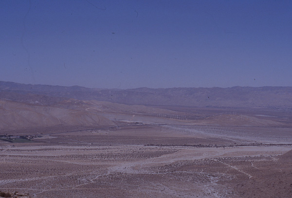
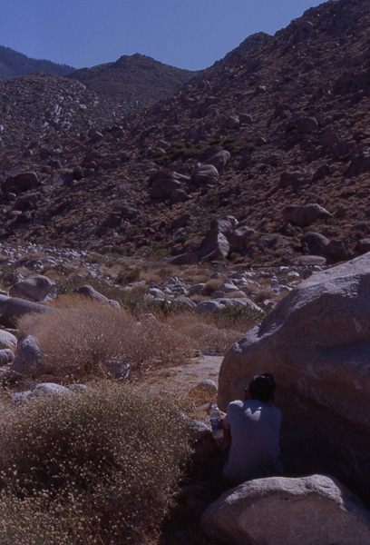
A view of barren San Gorgonio
pass as we make our decent back
into the desert.
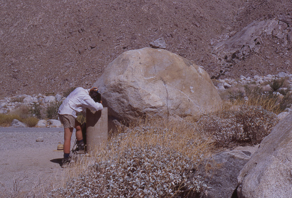
Amy gets up close and personal
with the Snow Canyon water
fountain.
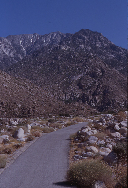
The mocking north face
of Mt. San Jacinto from
Snow Canyon Road. (By
the way...Snow Canyon?
Sound like wishful
thinking.
Scott huddles in (some
might say hogs) the
only shade around for
miles.
To be more specific, it was more like Hell's 20 Miles. We broke camp and headed out on what we anticipated would be a long grueling day of hiking.
We were not disappointed.
The reason we knew it would be difficult was that we would have to descend from our camp at 8,600 feet to 1188 feet, a drop of 7,412 feet. It was described in the guidebook as "a punishing decent." I don't feel that three words adequately describe this torture. Now, just switchbacking down a trail would be bad enough, but this trail wound all the way across the mountains, in and out of every crevice in sight and then would come back the other way, sometimes even managing to gain in elevation. We could see where our final destination was, but try getting there! Almost no shade for 20 miles and no water. And during this decent, you stare at the mocking north face of Mt. San Jacinto, which still has refreshing rivulets of snow clinging to it.
I started to entertain myself by playing one of my trail games, "Lost in the Desert," which involves me and my team of Borax mules and sometimes a bad outlaw, played by Scott.
The game goes like this: we're lost in the desert.
It's a pretty simple game. This was fun for a while until it started to become too realistic and I was forced to quit to protect my sanity.
Another disheartening thing about the trail is that while you are descending to San Gorgonio Pass, you stare at Mt. San Gorgonio (part of the San Bernardino Mts.) across the valley as it gets taller and you get shorter. Why is this bad? Because, day after tomorrow, we will head into the San Bernardinos and have to start climbing all over again.
Hours and hours later, we finally descended to a water fountain at the bottom of the mountain, installed by PCT volunteers and were we glad to see it! This fountain looks pretty funny standing by itself in the middle of the desert, but it was the best thing we'd seen all day. And the water was actually cool! Heaven! We have now completed 210 trail miles.
Carmen DiLorenzo picked us up in his brand new SUV. We had the honor of being some of the very first people to ride in the vehicle. (I'm sure Carmen considered it an honor as well.) He took us his home in Banning, where we are now. Carmen and Vincie DiLorenzo are Tony DiLorenzo's parents, another PCT hiker who is going all the way to Canada this year. (He started 3 weeks before us) We met Tony, Carmen, and Tony's brother, Paul, at mountaineering training school where we learned to use our ice axes. We discovered that both our parents live near the trail and arranged a "Parent Swap." Tony plans stay with Mom and Dad when he goes through the Mt. Lassen area. He is hiking the PCT to raise money and awareness about Thalassimia, a rare blood disease, more commonly called Cooley's Anemia. It is sort of the opposite of Leukemia. Paul has this disease--it's something you are born with. At many of the towns Tony stops in, the local paper does a story on his hike.
The DiLorenzo's are great people. We also got had the pleasure of meeting Tony's aunt and uncle as well and had a wonderful dinner, good conversation and of course, a shower! (And they remembered that Scott was a vegetarian and made sure he was well fed!)